Alum Cliffs Track
Alum Cliffs Track,
8kmDifficulty:
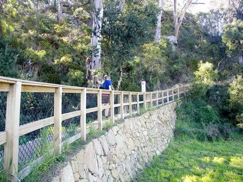
The route followed by today's Alum Cliffs Track has long been a coastal path used by local people. In 1988 it was formally developed as part of Australia's Bicentennial celebrations. In more recent years, Council has upgraded the southern section of the track, which climbs from Tyndall Beach through coastal blue gum forest with tall silver banksias. The track then winds up through silver peppermint bushland, dips into a glorious fern-filled gully, before rising again onto headlands for commanding views over Storm Bay and the Derwent Estuary. In 2016 Council completed the extension of the track from the historic Shot Tower to Wandella Avenue which then links in to the Taroona Foreshore Tracks if you wish to do a more extended walk.
The track provides an 8 km return trip, and the beginning of the track provides toilets, picnic facilities and parking with nearby Cafes at Kingston Beach. The track connects with the Brickfields Track and also can be linked with the Boronia Beach Track via a short stroll along Kingston Beach.


Tip Top Track
South Hobart,
1.5kmDifficulty:
This recently constructed, short, shared-use track on the slopes of South Hobart provides plenty of challenge for experienced cross-country mountain bike riders. The track grading is rated ‘Very difficult’ under the International Mountain Bicycling Association’s trail difficulty rating system due to its narrow, twisting and technically challenging route which includes two steep, paved, rock chutes.
Construction of the Tip Top Track was a collaborative effort between the City of Hobart, volunteers from the Hobart Trail Alliance and other volunteers from the local mountain bike community.
Riders are required to ride the trail downhill i.e. from west to east, due to the rock chutes. Riders must then return via the M4 fire trail as access to adjoining Cascade Brewery owned land is not provided.


Tawny Trail
Knocklofty Reserve,
1.5kmDifficulty:
Enjoy a peaceful bushland experience just minutes from the centre of Hobart. Even though the loop short and easy it packs in loads with beautiful bushland, wildlife and views across the city.
Starting and finishing at the Forest Road car park, the route quickly takes you into the tranquillity of Knocklofty Reserve. Although you are only a short distance from the Hobart CBD, it can feel like you are much further away. A lookout and rest area not far along the track provides a reminder of just how close the reserve is to the city, with views across Hobart.
Take your time as you travel through the reserve and keep an eye out for local wildlife, including Tawny Frogmouths. Knocklofty is a wonderful place to slow down, enjoy the sounds of the bush and experience nature close to the heart of Hobart.


Rosny Hill Circuit Track
Rosny,
2.8kmDifficulty:
One of the best short walks on Hobart’s eastern shore. The circuit track undulates around the perimeter of Rosny Hill taking in views of Kangaroo Bay, the Derwent River, Mt Wellington and the Tasman Bridge. A link track from the lookout connects to the circuit track.


Pipeline Track - Fern Tree to Waterworks Reserve
Fern Tree and Dynnyrne,
4.5kmDifficulty:
A well graded downhill track, with historic features highlighted by interpretation panels along the way. Dogs on lead are welcome between Fern Tree and Gentle Annie Falls, but not beyond Gentle Annie Falls.
From Fern Tree the track heads downhill with historic stonework apparent underfoot and two beautifully constructed stone aqueducts on the right. Below Chimney Pot Hill Road the forest becomes drier and more open. The track then emerges into a cleared area that was once McDermotts Farm; in spring daffodils bloom where the homestead once stood. Keep going a short way until you get to the Gentle Annie Falls look out. From here you may chose to descend down the steps cut into the rock to Gentle Annie Falls (a dry waterfall!) there are handrails but please be mindful that this is a very steep part of the track and not accessible for bikes and prams.
In 2025 a new gentle gradient, shared use track was constructed from the top of Gentle Annie Falls that zig zags down through the bush, with views of Kunanyi / Mount Wellington peaking through, following the historic Mountain Water Supply System features such as the base of Gentle Annie Falls, the Pipe Head Well until you reach the Receiving House and the reservoirs of Waterworks Reserve. This new track is accessible for a wider range of users.


Hobart Rivulet Park
South Hobart,
2.7kmDifficulty:
Following Hobart Rivulet upstream from the city to the foothills of Kunanyi / Mount Wellington, this trail has a gentle uphill grade and is well suited to bikes and dogs on lead.
Along the way keep your eyes on the water or waters edge for the platypus that call this rivulet home. These incredibly special animals living so close to Hobart City have become stars in a documentary called the Platypus Guardian. The documentary, local conservationists, South Hobart Primary School and the City of Hobart aim to raise awareness of the significant need for the protection of these beautiful animals and the places that they also call home.
This is also a culturally interesting walk. Until the 1860s Hobart Rivulet was the main source of fresh water for the new settlement and so the colony grew up along its banks. You will pass the World Heritage Listed Female Factory, an institution used to house convict women and their children.
Further upstream is the historic Cascade Brewery. The playground and barbecue facilities in Cascade Gardens make this an ideal spot to take a break before retracing your steps to the city.


Gentle Annie Falls Circuit
Waterworks Reserve, Dynnyrne,
1.3kmDifficulty:
A short, loop walk through open bushland and past a ‘dry waterfall’. Gentle Annie Falls is not an actual waterfall but a hand-cut channel in natural sandstone that was used to direct water into the Waterworks reservoirs. The ‘falls’ have been dry since the water was re-directed into the higher level Ridgeway Reservoir in the 1940s.
The walk begins with a short steep climb that brings you quite quickly to the base of Gentle Annie Falls. Steps cut into the stone and a hand-rail help you ascend to the top of the rock outcrop. After climbing back down follow the track through open forest before crossing Sandy Bay Rivulet and emerging at the Upper Reservoir.

City to Gardens Circuit
Queens Domain,
2.4kmDifficulty:
An enjoyable loop track leaving from either the The Bridge of Remembrance or the Royal Tasmanian Botanical Gardens. This route links a variety of natural and cultural heritage features, ideal for cyclists and dogs on lead.
Take a peaceful and reflective stroll between the cedar and cypress trees of the Soldiers Memorial Avenue. Planted in 1918, the Avenue has recently undergone extensive restoration. The adjacent grasslands are an important remnant of the native vegetation that was once widespread around Hobart and provide shelter and a valuable food source to many Tasmanian-endemic animal species such as the Eastern Barred Bandicoot and the Tasmanian Native Hen.
Visitors traveling on the City to Gardens Circuit will pass several key features located on the Lower Queens Domain on route to the Royal Tasmanian Botanical Gardens. These include the Soldiers Memorial Avenue, the historical Gunpowder Magazine and former guard house, Government House and the Beaumaris Zoo, where the last captive Tasmanian Tiger died in 1936.
The City of Hobart has developed a brochure dedicated to this reserve that can be downloaded from the website or a hard copy picked up from the Tasmanian Travel and Information Centre and shows a map and more information describing this suggested walk and others Nature Trails.

Clarence Coastal Trail - Blessington Track & Cape Deliverance
South Arm,
6.8kmDifficulty:
A beautiful 6.8km return coastal walk offering sweeping views of the Derwent estuary which finishes at Pot Beach and provides excellent views of the Iron Pot Lighthouse. The 1.7km long Blessington Track is narrow and undulating as it follows the coast reserve to Fort Beach where it drops down onto the sand. Walk along Fort Beach until you reach a track at the end that goes onto Cape Deliverance and the Lone Pine Memorial. Pot Beach is on the other side of the cape where there are views to Iron Pot and Bruny Island North.
A side track from Fort Beach where the houses above the dunes finish takes you to Fort Direction Road and Potters Hill.
Amy St Reserves
West Moonah,
1000mDifficulty:
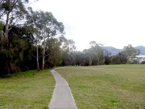
Take a stroll around Amy Street Community Park, on the edge of Barossa Hill with a stunning view overlooking the city towards the Derwent. This track is paved from Amy Street to Eleventh Avenue, with the full loop including an uphill gravel section.
This reserve contains over 75 native plant species, three of which are listed as threatened. Keep an eye out for the wildlife that still hang on in this urban island, including refuging wallabies and pademelons, and the watchful local, the threatened grey goshawk (white-morph).
Please take care not to disturb them as this is an increasingly isolated refuge for the wildlife of Moonah.

Rosny Parklands Circuit Track
Rosny Park, Rosny Park
1.69kmDifficulty:
A pleasant, easy walk around the Rosny Parklands, 18 hectares of open grassy areas, shady trees and habitat for native flora and fauna adjacent to the Rosny Park CBD. Visitors can observe bandicoots in the grasslands, native ducks in the Kangaroo Bay Rivulet and hear musk lorikeets when the blue gums are in flower. Native orchids proliferate the wild park area at the top of the parklands and a timber bridge crosses a small ephemeral creek part way around.
The 2m wide gravel track gains elevation on the northern side adjacent to the Tasman Hwy and offers views to the Meehan Range, Rokeby Hills and Wellington Range.
Joggers can do 3 laps for a 5km run.


Single Hill Circuit
Seven Mile Beach,
7.5kmDifficulty:
A loop combining the Clarence Coastal Trail with the Single Hill Track, the route offers estensive views across Frederick Henry Bay. From a memorial seat on the northern side of the summit there are views to the Coal River Valley and Dodges Ferry while the southern side has views to Lauderdale and Sandford. Keep an eye out for the New Holland Daisy that flowers over summer.
Follow the track along the Acton Creek for 50m until an intersection is reached with the Single Hill Track. Head up the hill and approximately 150m along the track amongst sheoaks and coastal vegetation is another intersection. Follow the signs for the Single Hill Track that zig zags uphill for 1.7km until a memorial seat is reached. Rest and take in the views over the Coal River Valley and Pittwater.
Continue over the flat summit (past the aerials and antennas) and follow the fire trail southwards through blue gum forest. The trail has a steep section and eventually reaches a TasWater reservoir and house site where the vehicle track is sealed. Go through fencing and follow the Tangara Trail across the open paddock while soaking up the views. Follow the trail to the bottom of the hill and turn left to head towards Kirra Road and the coastal trail.
Cross Kirra Road, follow the steepish track down to the coast and turn left. Continue along the undulating coastal track that contours around the bottom of Single Hill until reaching the start.


Potters Hill Labyrinth Track
South Arm,
800mDifficulty:
A steepish 400m climb from Fort Direction Road to the top of Potters Hill rewards with 360 degree views of South Arm Peninsula, Bruny Island and Tinderbox Hills. At the summit you can walk the labyrinth, which has a single circuitous path that winds its way into a centre and is used for meditation and serenity.
For those seeking a longer walk, there is a track on the high side of Fort Direction Road from the Potters Hill entry that links to the Coastal Trail by the turning circle. This is a pleasant beach walk that goes to Cape Deliverance at Fort Direction (south) or Blessington Coastal Track (north).

Single Hill-Wallaby Track loop
Roches Beach, Clarence
6.5kmDifficulty:
From Roches Beach Park carpark follow the Clarence Coastal Trail north for 500m until a track intersection is reached that heads uphill towards Kirra Road and Single Hill Reserve. Enter the reserve and follow the gravel track uphill . It crosses the Single Hill Fire Trail a couple of times as it zig zags up the slope, offering views across Frederick Hentry Bay towards Tasman Peninsula
The track comes out at an asphalt road by a TasWater reservoir. Continue up the fire trail to the summit. A memorial seat on the northern side of the hilltop provides a pleasant spot to rest and take in the view across Acton and Seven Mile Beach. Start heading down the zig zag track on the north side of the hill until an intersection with the Acton View Track is reached. This follows the fenceline towards the south and has a rougher, unformed surface which becomes steeper as it goes further down the hill. It eventually crosses the Toronto Track and a new gravel track continues down the slope through blue gum forest that transforms into Bursaria woodland that is abundant with wallabies. Continue following the gravel track until it eventually comes out at a fence at the southern end of the reserve and make your way back to the start.


Arm End Circuit
Arm End Circuit,
6kmDifficulty:
A pleasant 2hr walk along a mown track through mostly open grassland with fantastic views of the Derwent estuary and kunanyi/Mount Wellington. There are secluded beaches, lots of bird life including wedge-tailed eagles and many rabbit burrows throughout the reserve so please watch your step. The area is rich in Aboriginal heritage and was part of the land of the Muriminina people prior to colonisation. The land was granted by colonial authorities to William Gellibrand who built a home on the property, cleared the land for farming and constructed his own tomb at Mary Ann Bay, which can still be seen. The track follows the coast of the peninsula passing Shelly Beach, Gellibrand Point, Mary Ann Bay and Mitchells Beach. There is an alternative inland route between Mary Ann Bay and White Rock Point that goes over the small hills in the reserve. The reserve is managed by the Tasmanian Parks and Wildlife Service.


Lauderdale Wetlands Track
Lauderdale,
701mDifficulty:
The track around the perimeter of the wetlands takes 15-20 minutes to walk. The man-made wetlands were established by Clarence Council to trap and treat stormwater from its surrounds in Lauderdale. The wetlands consists of a series of channels and bioretention basins which allow water to be filtered by planted native rushes and sedges. The area has been transformed to a vibrant wetland community which hosts a variety of insects, birds, native mammals, fish and other fresh water aquatic biota. The walk connects to the Tangara Trail at the southern end of Roscommon Reserve.

Lauderdale Saltmarsh Island Circuit
Lauderdale, Clarence
2.2kmDifficulty:
The circuit track follow the perimeter of a grassland area ringed by trees and offers elevated views across the Lauderdale saltmarsh, the largest in southern Tasmania.
The saltmarsh comprises salt tolerant sedges, grasses and shrubs on elevated fringes that provide shelter for small native mice and antechinus as well as small birds like white-fronted chats, striated field wrens and fairy wrens. Swamp harriers (large brown hawk with wings in an upswept V-shape) soar over the saltmarsh looking for small mammals and snakes.
Succulent herblands occur in the wettest and low lying areas and include pigface, wilsonia and samphire (an edible known as sea pickle or poor mans asparagus). They provide a colourful groundcover when they flower in summer.
Starting from the small carpark off South Arm Hwy (by the water filling station south of Lauderdale oval), go through the metal framework and follow the gravel track towards the southern side of Lauderdale oval until a junction is reached. Turn right and head uphill towards the elevated section of the reserve. At the top of the rise turn left and follow the track around the perimeter for 1.5km until you reach a vehicle track that heads back down the slope towards the carparking area.
The walk is 2.2kms in total and takes less than an 1 hour.

Bicentennial Circuit
Bicentennial Park, Hobart
5kmDifficulty:
South of Hobart is Bicentennial Park, and the locals will tell you views from the Signal Station at the top of Kriwalayti / Mount Nelson give Kunanyi / Mt Wellington a run for its money.
There are several great trail options in Bicentennial Park. You can base yourself at the top - there is plenty of parking and public buses will also get you there – and follow the Skyline Walk for sea views, or take the shorter Signal Station Circuit.
You can also start your walk from either Lambert Park, following Lambert Rivulet up through beautiful rainforest into dry forest and then the heritage-listed Signal Station, or at the other end in Cartwright Reserve, taking Truganini Track to the Signal Station. Please note that Truganini Track and Cartwright Reserve does not allow dogs. However over the other side of Sandy Bay Road from Cartwright Reserve is Waylranyi / Cartwright Point which is a dog off-lead area.
If you car shuffle or use public transport you can walk the entire 5 km Bicentennial Circuit. The City of Hobart has a brochure for this reserve, describing this suggested walk and others Nature Trails.

Tranmere Foreshore Trail
Tranmere, Clarence
7kmDifficulty:
The walk is 3.5km one way and follows the Tranmere foreshore, finishing at the Pindos Park playground which has BBQ facilities. The first part of the walk is a gravel track located within the foreshore reserve. The only toilets are located halfway along the walk where the path leaves the foreshore reserve and follows along the side of Tranmere Road. Eventually the path returns to a foreshore reserve near Pindos Park.

Gordons Hill Circuit
Rose Bay, Clarence
2.632kmDifficulty:
A pleasant and relatively easy circuit walk around the perimeter for Gordons Hill Reserve, though steep in a few places. Follow the bitumen track up the hill from the carpark past the reserve entry sign and turn right (in an anti-clockwise direction). Follow the fairly level contour track around the SE side of the reserve, eventually passing a set of wooden steps on the left. Continue along the track until you reach a steep section behind rear fences of houses. which goes uphill but eventually levels out. Continue to follow the undulating circuit around until you return to the start. Keep an eye out for pademelons (small wallabys).
The bitumen track by the carpark is also the start of a trail that goes to the top of the hill for a side trip. Bicycles are not allowed on this track.