


Rosny Parklands Circuit Track
Rosny Park, Rosny Park
1.69kmDifficulty:
A pleasant, easy walk around the Rosny Parklands, 18 hectares of open grassy areas, shady trees and habitat for native flora and fauna adjacent to the Rosny Park CBD. Visitors can observe bandicoots in the grasslands, native ducks in the Kangaroo Bay Rivulet and hear musk lorikeets when the blue gums are in flower. Native orchids proliferate the wild park area at the top of the parklands and a timber bridge crosses a small ephemeral creek part way around.
The 2m wide gravel track gains elevation on the northern side adjacent to the Tasman Hwy and offers views to the Meehan Range, Rokeby Hills and Wellington Range.
Joggers can do 3 laps for a 5km run.





Single Hill Circuit
Seven Mile Beach,
7.5kmDifficulty:
A loop combining the Clarence Coastal Trail with the Single Hill Track, the route offers estensive views across Frederick Henry Bay. From a memorial seat on the northern side of the summit there are views to the Coal River Valley and Dodges Ferry while the southern side has views to Lauderdale and Sandford. Keep an eye out for the New Holland Daisy that flowers over summer.
Follow the track along the Acton Creek for 50m until an intersection is reached with the Single Hill Track. Head up the hill and approximately 150m along the track amongst sheoaks and coastal vegetation is another intersection. Follow the signs for the Single Hill Track that zig zags uphill for 1.7km until a memorial seat is reached. Rest and take in the views over the Coal River Valley and Pittwater.
Continue over the flat summit (past the aerials and antennas) and follow the fire trail southwards through blue gum forest. The trail has a steep section and eventually reaches a TasWater reservoir and house site where the vehicle track is sealed. Go through fencing and follow the Tangara Trail across the open paddock while soaking up the views. Follow the trail to the bottom of the hill and turn left to head towards Kirra Road and the coastal trail.
Cross Kirra Road, follow the steepish track down to the coast and turn left. Continue along the undulating coastal track that contours around the bottom of Single Hill until reaching the start.


Potters Hill Labyrinth Track
South Arm,
800mDifficulty:
A steepish 400m climb from Fort Direction Road to the top of Potters Hill rewards with 360 degree views of South Arm Peninsula, Bruny Island and Tinderbox Hills. At the summit you can walk the labyrinth, which has a single circuitous path that winds its way into a centre and is used for meditation and serenity.
For those seeking a longer walk, there is a track on the high side of Fort Direction Road from the Potters Hill entry that links to the Coastal Trail by the turning circle. This is a pleasant beach walk that goes to Cape Deliverance at Fort Direction (south) or Blessington Coastal Track (north).

Single Hill-Wallaby Track loop
Roches Beach, Clarence
6.5kmDifficulty:
From Roches Beach Park carpark follow the Clarence Coastal Trail north for 500m until a track intersection is reached that heads uphill towards Kirra Road and Single Hill Reserve. Enter the reserve and follow the gravel track uphill . It crosses the Single Hill Fire Trail a couple of times as it zig zags up the slope, offering views across Frederick Hentry Bay towards Tasman Peninsula
The track comes out at an asphalt road by a TasWater reservoir. Continue up the fire trail to the summit. A memorial seat on the northern side of the hilltop provides a pleasant spot to rest and take in the view across Acton and Seven Mile Beach. Start heading down the zig zag track on the north side of the hill until an intersection with the Acton View Track is reached. This follows the fenceline towards the south and has a rougher, unformed surface which becomes steeper as it goes further down the hill. It eventually crosses the Toronto Track and a new gravel track continues down the slope through blue gum forest that transforms into Bursaria woodland that is abundant with wallabies. Continue following the gravel track until it eventually comes out at a fence at the southern end of the reserve and make your way back to the start.


Arm End Circuit
Arm End Circuit,
6kmDifficulty:
A pleasant 2hr walk along a mown track through mostly open grassland with fantastic views of the Derwent estuary and kunanyi/Mount Wellington. There are secluded beaches, lots of bird life including wedge-tailed eagles and many rabbit burrows throughout the reserve so please watch your step. The area is rich in Aboriginal heritage and was part of the land of the Muriminina people prior to colonisation. The land was granted by colonial authorities to William Gellibrand who built a home on the property, cleared the land for farming and constructed his own tomb at Mary Ann Bay, which can still be seen. The track follows the coast of the peninsula passing Shelly Beach, Gellibrand Point, Mary Ann Bay and Mitchells Beach. There is an alternative inland route between Mary Ann Bay and White Rock Point that goes over the small hills in the reserve. The reserve is managed by the Tasmanian Parks and Wildlife Service.



Lauderdale Wetlands Track
Lauderdale,
701mDifficulty:
The track around the perimeter of the wetlands takes 15-20 minutes to walk. The man-made wetlands were established by Clarence Council to trap and treat stormwater from its surrounds in Lauderdale. The wetlands consists of a series of channels and bioretention basins which allow water to be filtered by planted native rushes and sedges. The area has been transformed to a vibrant wetland community which hosts a variety of insects, birds, native mammals, fish and other fresh water aquatic biota. The walk connects to the Tangara Trail at the southern end of Roscommon Reserve.
Amy St Reserves
West Moonah,
1000mDifficulty:
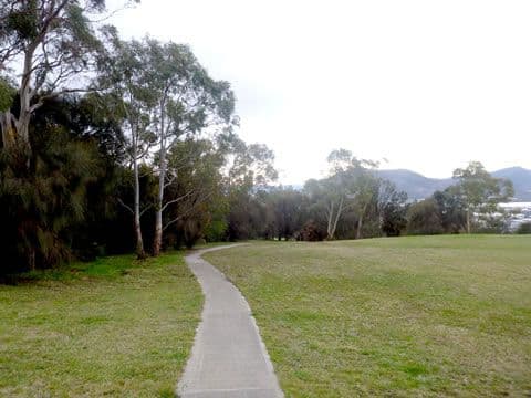
Take a stroll around Amy Street Community Park, on the edge of Barossa Hill with a stunning view overlooking the city towards the Derwent. This track is paved from Amy Street to Eleventh Avenue, with the full loop including an uphill gravel section.
This reserve contains over 75 native plant species, three of which are listed as threatened. Keep an eye out for the wildlife that still hang on in this urban island, including refuging wallabies and pademelons, and the watchful local, the threatened grey goshawk (white-morph).
Please take care not to disturb them as this is an increasingly isolated refuge for the wildlife of Moonah.

Lauderdale Saltmarsh Island Circuit
Lauderdale, Clarence
2.2kmDifficulty:
The circuit track follow the perimeter of a grassland area ringed by trees and offers elevated views across the Lauderdale saltmarsh, the largest in southern Tasmania.
The saltmarsh comprises salt tolerant sedges, grasses and shrubs on elevated fringes that provide shelter for small native mice and antechinus as well as small birds like white-fronted chats, striated field wrens and fairy wrens. Swamp harriers (large brown hawk with wings in an upswept V-shape) soar over the saltmarsh looking for small mammals and snakes.
Succulent herblands occur in the wettest and low lying areas and include pigface, wilsonia and samphire (an edible known as sea pickle or poor mans asparagus). They provide a colourful groundcover when they flower in summer.
Starting from the small carpark off South Arm Hwy (by the water filling station south of Lauderdale oval), go through the metal framework and follow the gravel track towards the southern side of Lauderdale oval until a junction is reached. Turn right and head uphill towards the elevated section of the reserve. At the top of the rise turn left and follow the track around the perimeter for 1.5km until you reach a vehicle track that heads back down the slope towards the carparking area.
The walk is 2.2kms in total and takes less than an 1 hour.

Tawny Trail
Knocklofty Reserve, Hobart
1.5kmDifficulty:
This loop is a shorter and easier version of the Knocklofty Summit Loop but just as beautiful. The loop starts and finishes at the Forest Road car park, the main car park for Knocklofty Reserve. You are minutes away from the city but suddenly you feel hours away. The only reminder of your proximity to the Hobart CBD is the view at the rest/lookout spot just a little way along the track. Keep an eye out for Tawny Frogmouths along the way and enjoy the tranquillity of this nature reserve that we feel so lucky to have right in the middle of Hobart.
This track can be accessed with the City of Hobart rough terrain wheelchair TrailRider (free to hire from the Doone Kennedy Hobart Aquatic Centre) 7 days a week.


Bicentennial Circuit
Bicentennial Park, Hobart
5kmDifficulty:
South of Hobart is Bicentennial Park, and the locals will tell you views from the Signal Station at the top of Kriwalayti / Mount Nelson give Kunanyi / Mt Wellington a run for its money.
There are several great trail options in Bicentennial Park. You can base yourself at the top - there is plenty of parking and public buses will also get you there – and follow the Skyline Walk for sea views, or take the shorter Signal Station Circuit.
You can also start your walk from either Lambert Park, following Lambert Rivulet up through beautiful rainforest into dry forest and then the heritage-listed Signal Station, or at the other end in Cartwright Reserve, taking Truganini Track to the Signal Station. Please note that Truganini Track and Cartwright Reserve does not allow dogs. However over the other side of Sandy Bay Road from Cartwright Reserve is Waylranyi / Cartwright Point which is a dog off-lead area.
If you car shuffle or use public transport you can walk the entire 5 km Bicentennial Circuit. The City of Hobart has a brochure for this reserve, describing this suggested walk and others Nature Trails.


Tranmere Foreshore Trail
Tranmere, Clarence
7kmDifficulty:
The walk is 3.5km one way and follows the Tranmere foreshore, finishing at the Pindos Park playground which has BBQ facilities. The first part of the walk is a gravel track located within the foreshore reserve. The only toilets are located halfway along the walk where the path leaves the foreshore reserve and follows along the side of Tranmere Road. Eventually the path returns to a foreshore reserve near Pindos Park.

Gordons Hill Circuit
Rose Bay, Clarence
2.632kmDifficulty:
A pleasant and relatively easy circuit walk around the perimeter for Gordons Hill Reserve, though steep in a few places. Follow the bitumen track up the hill from the carpark past the reserve entry sign and turn right (in an anti-clockwise direction). Follow the fairly level contour track around the SE side of the reserve, eventually passing a set of wooden steps on the left. Continue along the track until you reach a steep section behind rear fences of houses. which goes uphill but eventually levels out. Continue to follow the undulating circuit around until you return to the start. Keep an eye out for pademelons (small wallabys).
The bitumen track by the carpark is also the start of a trail that goes to the top of the hill for a side trip. Bicycles are not allowed on this track.

naniyilipata / Clarence Plains Historic Trail
Rokeby, Clarence
3.97kmDifficulty:
You will be walking on the land of the Mumirimina people who called the area naniyilipata*. Their homeland comprised the eastern shore of the River Derwent/Timtumil Minanya, extending from the Jordan River to South Arm, and eastwards from the Derwent to Pitt Water and Coal River.
*Names of places in palawa kani, the language of Tasmanian Aborigines, are used with approval of the Tasmanian Aboriginal Centre.
Starting at St Matthews Church on North Parade in Rokeby, the trail visits historic sites and natural areas around Clarence Plains. There are 14 interpretive signs providing insight into the history of one of the earliest colonised parts of Tasmania, with settlers arriving from Norfolk Island in 1808.
St Matthews Church & cemetery
Life on the Green
Historic cemetery
Rokeby Aflame
The Percy’s Legacy
The Nutshell
Norfolk Islanders
School Days
Village entrance (Old Watchhouse)
Mumirimina people
Dual heritage
Prominent Houses
Between the hills and the bay
Life on the Bay (Rokeby Beach)
The trail was developed by the Tranmere and Clarence Plains Land and Coastcare group and was based on the Centenary of Federation Old Rokeby Historic Trail.


Mortimer Bay Circuit
Sandford, Clarence
11kmDifficulty:🟢
A scenic, undulating walk along the coastline of Mortimer Bay. Hidden beaches are scattered along the coast and there are views across the bay to Arm End. Head south from the Mortimer Bay carpark and follow the coast to Palana Court. From here the track heads inland following Palana Court roadway uphill until reaching Gellibrand Drive. Cross the road and pick up the pad on the other side which heads downhill towards South Arm Hwy.
Near the South Arm Hwy intersection the track veers left and follows the boundary fence for approximately 250m to an opening in the fence line where the Storm Bay View Track heads steeply uphill. Bikers will need to get off and push their bikes for 200m until the track flattens out and heads north, following the contour.
In 800m you will pass the intersection with the Calverts Lagoon Track. Continue following the contour track for another 850m where it turns to the left and switchbacks uphill towards Gellibrand Drive. At the top, follow the track along the fence line, heading north on Gellibrand Drive for 500m until you reach the intersection with Hidden Valley Track. Head downhill on the Hidden Valley Track for a kilometre before meeting the intersection with the Emu Track. Head north on the Emu Track. Keep an eye out for the emu farm on your right. It's easy to spot as the property is bare earth.
The Emu Track exits onto a sandy road. Turn left and cross Gellibrand Drive and back to the carpark at Mortimer Bay.


Waverly Flora Park - Avenue of Honour & Quarry Loop
Mornington, Clarence
1.5kmDifficulty:
Discover hidden gems in Waverly Flora Park. The walk starts on the Avenue of Honour, which was planted to honour members of the Bellerive Rifle Club who served in the First World War. The Armistice Memorial sculpture takes inspiration from the shape of a rifle butt and poppy.
At the trail intersection go left and follow the signs for the Quarry Track. A short detour takes you to Pitfield Quarry. The quarry operated in the mid-1800s and supplied stone for many prominent buildings in Hobart and Melbourne (such as the University of Melbourne). Look for the lion head in the quarry face.
Continue to an intersection with a stone wall and turn right, climbing uphill until you reach a lookout over a rock ledge. Enjoy the views over Mornington and the Meehan Range. Eventually the track meets with the Charles Darwin Trail. Turn right and head downhill where a lookout over Pitfield Quarry provides views to Kunanyi / Mt Wellington.
Continue down to the trail intersection with the Avenue of Honour and return to Quarry Road.
Fossil Grove
South Hobart, Hobart
400mDifficulty:
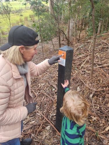
This 'micro hike' takes in four interpretation panels installed by the Wellington Park Management Trust telling the story of some massive veterans of the 1967 bushfires. These Eucalyptus globulus (blue gum) and Eucalyptus obliqua (stringy bark) trees are well worth a visit. The first part of the walk is open, but a bit steep and slippery so wear sturdy shoes. The second part dives into the forest, and there’s no track so watch your step. It leads past some more large blue gums and follows some wallaby tracks back to the start. Total walking time is less than 15 minutes but take your time to enjoy these magnificent elders of our bushland!

Springs Lookout and Exhibition Gardens
Wellington Park, Hobart
600mDifficulty:
The Wellington Park Management Trust has recently installed an interpretation sign that tells the story of the Exhibition Gardens.
This easy 10-minute loop starts from the lower Springs Car Park and leads first to the charming Springs Lookout. Perched 10 m above the hidden Pinnacle Road, this hidden gem commands epic views over the city, the foothills of Kunanyi / Mount Wellington, the Derwent Estuary, Hobart, Storm Bay, and Bruny Island.
The route continues around the site of the former Exhibition Gardens and provides the best views from The Springs back towards The Pinnacle and the Organ Pipes. It emerges on a marsupial lawn where wallabies, pademelons, and other furry friends might be seen feeding at dusk.
The surface is level and wide and made of compacted gravel, so it is accessible for wheelchairs and prams—perhaps with a little assistance on a very short, gentle section up to the main Springs Picnic Area, which has a cafe, toilets, and more parking.
Skyline Walk
Bicentennial Park, Hobart
6.7kmDifficulty:
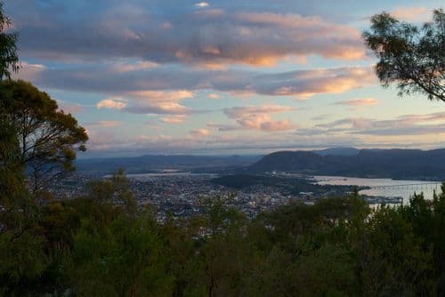
This walk has it all from fern gullies and rivulets to open eucalyptus forest with stunning views over the to the City and Derwent River.
Start from either Kriwalayti / Mount Nelson Signal Station or Lambert Park. If starting from the Signal Station go down the Signal Station Track to the foot bridge crossing Lambert Rivulet. Return back up Lambert Rivulet Track until you get to Nelson Road, travel a short distance along the side of Nelson Road, turn into Rialannah Road, then onto Rialannah Fire Trail and walking track, before taking Enterprise Fire Trail back to the Signal Station.
The City of Hobart has a brochure for this reserve, describing this suggested walk and others Nature Trails.

Natural and European Heritage Feature Mix Trail
Wellington Park, Hobart
4.8kmDifficulty:
This is a moderately challenging 2 hour loop from The Springs that visits a variety of vegetation types and features of European Historic Heritage interest. Start down the historic Radfords Track which was the old way to The Springs before there was a road. Steep and rocky but wide, it is shared with bikes so keep an eye and ear ahead and behind you. Pass Reids Track then Middle Track on your right and take the first left onto the Fern Gully Track at the monument to William Radford, who succumbed to hypothermia at age 19 after finishing the race to the Pinnacle in 1925. Cross the Fingerpost Track and look for the sign pointing to a very short side trip to Rocky Whelan's cave. This notorious bushranger hid out here while on the run after committing some very nasty deeds indeed! An interpretative sign tells his colourful story as you approach the cave. Cross the Pinnacle Road and head down the steep and slippery Woods Track then turn left at the bottom to cross O'Grady's Falls on a footbridge. Continue up to the top of the Betts Vale Track and turn right on the Circle Track which climbs briefly and meets Shoobridge Track. 5 mins along the Shoobridge Track brings you to the amazing Octopus Tree. Make sure you do a quick loop around the whole tree to understand how it got its name! Continue a few metres up Shoobridge Track then turn hard left up the North South Track to complete the final 1.1km gradually uphill to The Springs. Be careful of bikes sharing the North South Track. Finish with an organic hot chocolate from the Lost Freight Cafe at the Springs, where you will hopefully find some sunshine or a log fire.
Lambert Park to the Signal Station
Bicentennial Park, Hobart
2.9kmDifficulty:
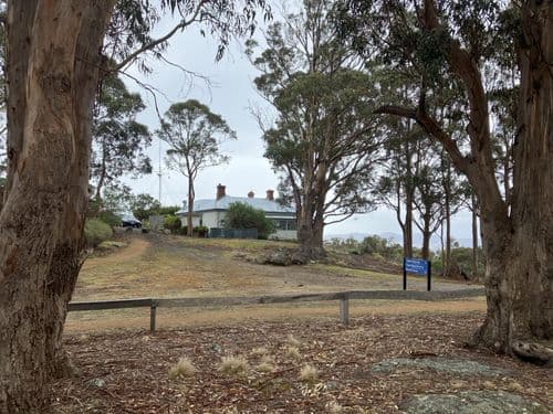
This is is a moderate walk starting from Lambert Park in Sandy Bay and takes you up to the Signal Station with its 180 degree views of the Derwent Estuary and beyond.
The Signal Station itself is originally the site of one of a chain of signal stations that linked Hobart Town with Port Arthur. It is now a heritage listed site and has been restored to offer visitors a glimpse into Tasmania’s maritime past. The history of the Signal Station at Mount Nelson is a fascinating tale of communication, maritime safety, and Tasmania's colonial past. The Mount Nelson Signal Station, situated on the southern slopes of Mount Nelson near Hobart, Tasmania, was established in the early 19th century. It was constructed to provide critical communication between Hobart and ships in the surrounding waters of the Derwent River and Storm Bay. In the era before modern technology, communication with ships at sea was vital for maritime safety. The Signal Station used a system of flags, semaphore, and signals to relay messages to and from ships approaching the port of Hobart. It played a crucial role in guiding ships through the often treacherous waters of the Derwent River, helping them navigate safely to their berths.