

Margate Rivulet Track

Getting There
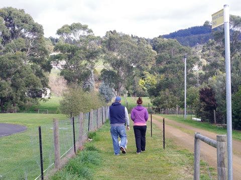
Margate Rivulet Track can be accessed from numerous locations including Channel Highway (adjacent to the Sandfly Rd bridge), Day Spring Drive, Rollins Rd and Brook Lane.
This return walk is more than just rolling green hills and friendly horses, it’s also rich in local history. Back in 1818, Margate was a convict sawing station. The station operated for around seven years, supplying much of the timber for the early Hobart buildings. The dry stone wall in Davis Flat, a good picnic spot, are believed to be convict built. Margate was also a fruit and hop growing district, and a timber and ship building port.
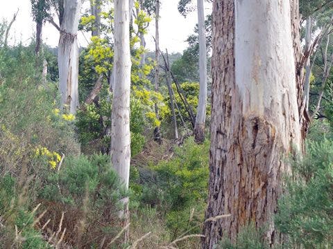
You’ll also see recent plantings of black and white gums – important food for swift parrots and forty-spotted pardalotes, both threatened species. Lucky observers may even spot platypus in the creek, or find a native orchid. And on a fine day, you’ll have great views to the distant Snug Tiers. Council has extended the track south to Brook Lane, thanks to a generous land donation, as well as north to the Channel Highway with the help of enthusiastic Green Corps volunteers. The Tramway Hill Landcare Group cares for this site.
| Activity | Suggested Time | Difficulty |
|---|---|---|
| Under 2 hours | ||
| Under 2 hours | ||
| Under 2 hours | 🟢 | |
| Under 2 hours |

Track Features
Dogs allowed on lead.
Plan your visit
Leave No Trace is an internationally accepted way of minimising impacts on the places we visit. Respect wildlife, be considerate with others, dispose your waste properly.
Be prepared for the walk. Plan your trip ahead, bring enough water, check the alerts, and make sure you are comfortable with the difficulty rating.
Recommended Trails

Track contacts

If you have any questions, feedback or updates regarding this track please contact the track manager at the Kingborough Council by phone on 03 6211 8200 or by email to kc@kingborough.tas.gov.au. For urgent communications please contact us by phone.
